
BT_998 |
E_814 |
E_815 |
Es_874 |
Es_875 |
Es_876 |
Es_877 |
Es_878 |

EVG_809 |
EVG_861 |
EVG_862 |
EZ_957 |
G_806 |
G_810 |
G_811 |
G_872 |
GVG_805 |
J&EG_817 |
J&EG_818 |
J&Es_879 |
J&Es_880 |

J+S_867 |
J+S_868 |
J_840 |
jBT_999 |
JG_841 |
JG_980 |
JG_981 |
JG_984 |

Jr_916 |
JrG_915 |
JT_000 |

JTG_803 |
JV_859 |
JVG_807 |
JVG_808 |
JVG_860 |
M_985 |
M_986 |
M_987 |
s1_990 |
s_799 |
s_800 |
s_850 |
s_851 |
s_852 |
s_865 |
s_941 |
s_942 |
s_982 |
s_983 |
s_988 |
s_989 |
smp_856 |
smp_857 |
T_842 |
T_953 |
T_973 |
V+G_873 |
V_801 |
V_802 |
V_804 |

V_813 |
V_849 |
V_869 |
V_971 |

VG_812 |
VG_816 |
VG_848 |
VG_907 |
VG_929 |
VG_969 |
VG_970 |
VG_972 |
VG_974 |
VG_978 |
VG_979 |

VGG_854 |
VGG_855 |

VGr914 |
VH_871 |
VHR_853 |
VL_927 |
VL_928 |
Vr_835 |
Vr_836 |
VR_866 |
Vs_870 |

Vs_881 |
Vs_912 |
Vs_913 |
Vs_917 |
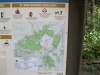
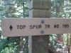
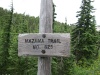
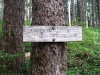
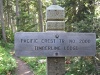
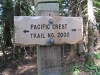
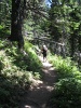
Driving Directions to the Top Spur Trailhead
Drive East on Highway 26 to ZizZag and turn left on East Lolo Pass Road.
Note Lolo Pass Rd. is just past the Zigzag Inn on your right.
The Zigzag Ranger Station is on your right just past the East Lolo Pass Rd.
Drive up the Lolo Pass Rd approx 4.2 miles and turn right onto Rd 1825 (Ramona Falls).
On Rd 1825, after 0.7 miles your come to a bridge over the Sandy River.
(that bridge goes to Ramona Falls).
DONOT turn onto the bridge.
Continue for 5.6 mile on paved road 1828.
After 5.6 miles on road 1828, turn right onto dirt road 118.
Proceed 1.5 miles to the trailhead.
Note a Forest Pass is required.


 fm_894.jpg)
 fa_826.jpg)
 fgG_889.jpg)
 fb_899.jpg)
 fT_992.jpg)
 f1_819.jpg)
 fxG_943.jpg)
 fL_922.jpg)
 f2_966.jpg)